Planning a trip to Caorle becomes much easier when you have a clear map of Caorle to guide you. This colourful seaside town in northern Italy is full of sandy beaches, a historic centre and kilometres of waterfront promenades.
In this article, we will walk through everything you need to know about using a Caorle map, from understanding the town’s layout to navigating the beaches, districts, and local transport.
The seaside town of Caorle
Caorle is on the Adriatic Coast in the Veneto region, around one hour from Venice.
It is about 153.84 km² and has a population of roughly 11,600 residents. It’s known for its mix of small-town charm and resort-style amenities, and despite its size, Caorle is one of the most visited destinations in the Veneto.
Many visitors come here for its 18 kilometres of sandy coastline, the lively old town filled with narrow “calli” and pastel houses, and the iconic lagoon area full of traditional fishing huts known as casoni.
Understanding the Caorle map
A typical Caorle map highlights three essential features:
- The coastline
- The historic centre
- The lagoon
The coast is curved, and divided into the lido of Caorle: Levante (east) and Ponente (west) beaches.
The historic centre sits between them, easily seen on any Caorle Italy map thanks to its dense grid of narrow streets. To the west and south, you’ll find Porto Santa Margherita, Lido di Altanea, and Duna Verde.
When reading the map of Caorle, we suggest you note that the coastline is oriented northeast–southwest. Levante lines the eastern stretch while Ponente faces more westward.
The town is flat, making the distance on the map very easy to translate into a walk or bike ride. Digital maps of Caorle often include layers for beach facilities, cycle paths, walking routes, and boat excursions into the lagoon.
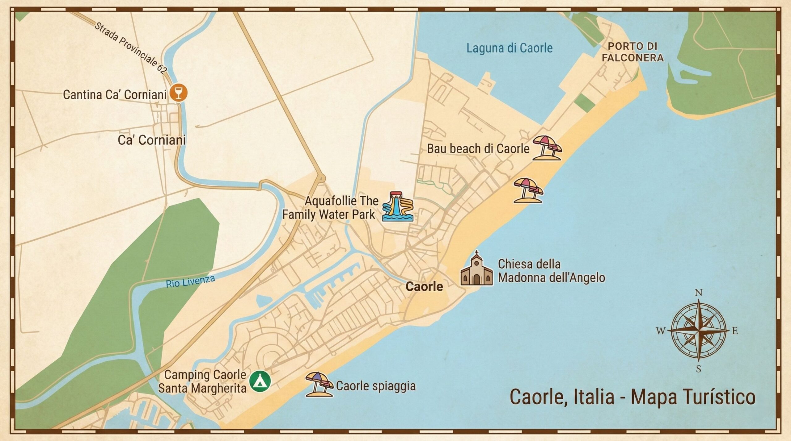
What to look for on a Caorle map
- Beaches and access points
- Hotels, apartments, and holiday villages
- Historic landmarks (Cathedral of St. Stephen, cylindrical bell tower, Santuario Madonna dell’Angelo)
- Cycle paths linking the centre to Altanea and Duna Verde
- Bus stops and parking zones
- Marina and port areas
Tip: Consider downloading a PDF or offline version before arrival. This is especially useful if you want to explore the old town without relying on mobile data.
Main areas and districts in Caorle
Although compact, Caorle contains several districts that often appear on a Caorle Italy map.
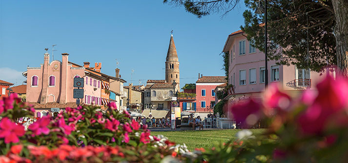
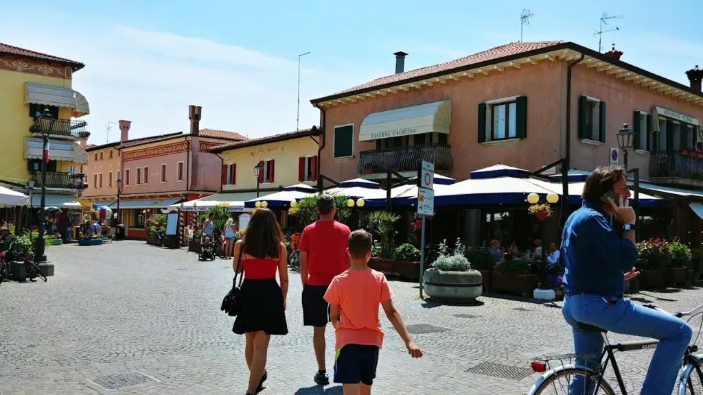
Historic Centre (Centro Storico)
A maze of colourful Venetian houses, small squares, and artisan shops. This is the cultural heart of Caorle.
The area is full of character and ideal for photography, and it is also close to the main lido, making it easy to enjoy the coastline. Additionally, everything is within walking distance, including restaurants and local events. However, it can become quite busy during the summer months, and parking is limited, which may be inconvenient if you’re arriving by car.
Levante
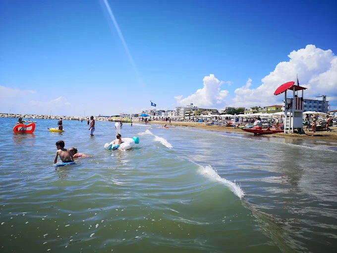
Located east of the centre, Levante Beach is lively and well-equipped, making it popular with families.
This area has many beachfront services and is conveniently close to water parks and children’s clubs, making it especially appealing for families. It also provides beautiful sunrise views along the coast. However, it can become crowded between July and August, which may not be ideal if you prefer a quieter atmosphere.
Ponente
The western beach district is wider, quieter, and more relaxed.
This zone has a calm atmosphere and is ideal for long walks and cycling, offering a relaxing break from the busier parts of Caorle. However, it does have fewer nightlife options, which may be a drawback if you are looking for evening entertainment.
Porto Santa Margherita
Located across the Livenza River, linked by a bridge, this district is modern and residential.
Lido di Altanea & Duna Verde
Both are planned resort areas south of Caorle, with large green zones, wide beaches, and holiday complexes.
Checklist of what to see in each area:
- Historic Centre → bell tower, cathedral, alleyways
- Levante → beach clubs, water activities
- Ponente → long promenade, sunsets
- Porto Santa Margherita → marina
- Altanea/Duna Verde → spacious beaches, cycling routes
Beaches and waterfront zones
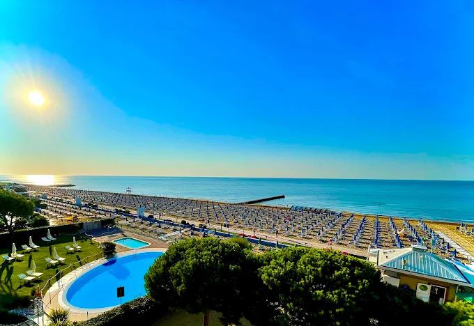
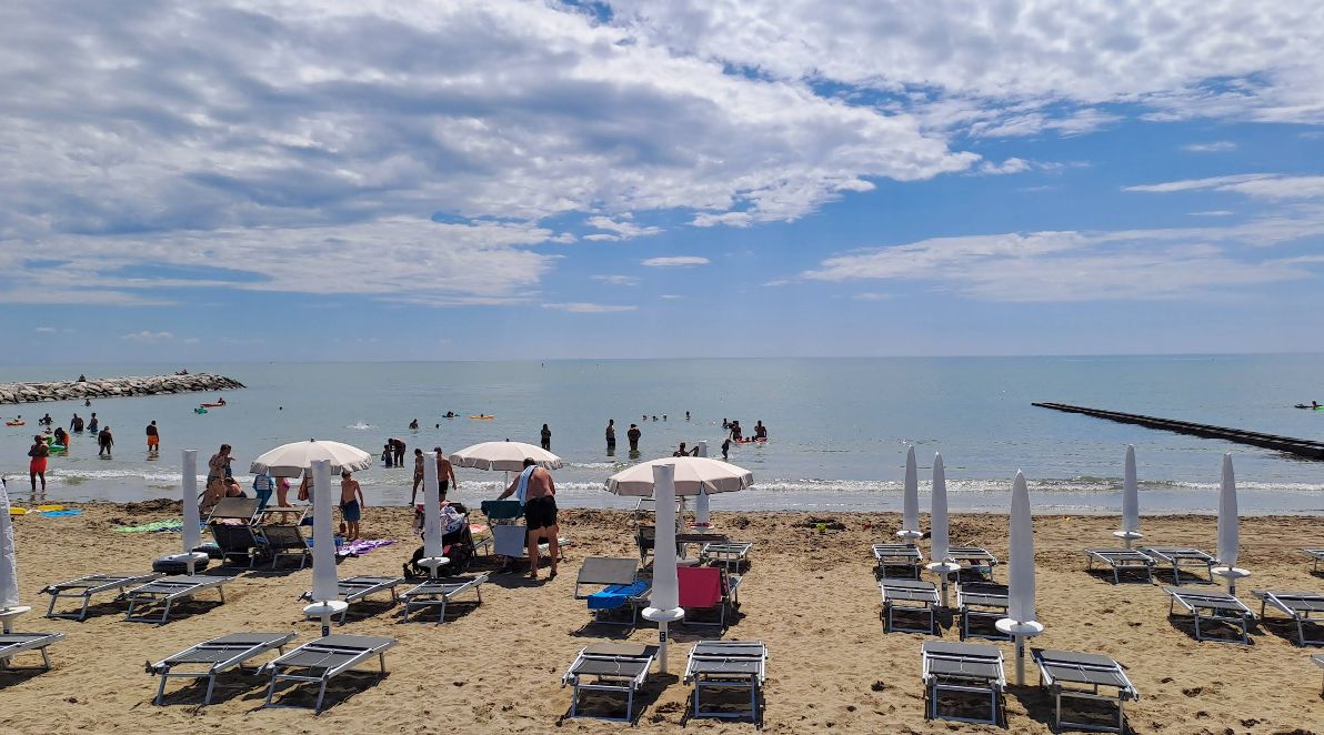
Caorle’s coastline spans 18 kilometres, making the beaches one of the main highlights on any Caorle map. Facilities typically include parasols, sun-beds, lifeguards, showers, playgrounds, and sports courts.
Main Beaches
Spiaggia di Levante: vibrant, colourful, near the historic centre
Spiaggia di Ponente: quieter, wider, great for families and walkers
Lido di Altanea: modern, well-equipped, clean
Duna Verde: surrounded by nature and pine trees
Whaterfront highlights you should not miss
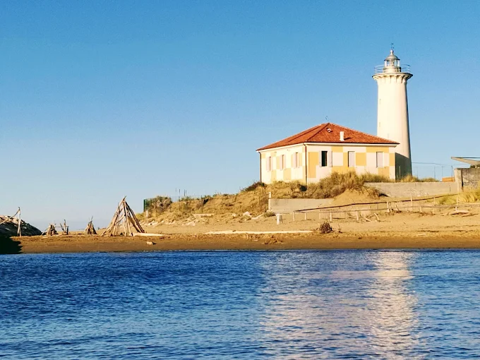
Along the waterfront, Lungomare Petronia is a scenic promenade perfect for leisurely walks, while Scogliera Viva is an impressive outdoor sculpture exhibition carved directly into the coastal rocks. Additionally, the Santuario della Madonna dell’Angelo stands out as one of the town’s most iconic and picturesque landmarks.

How to get around Caorle
Caorle is very walkable, and most visitors get around easily with a digital or printed map of Caorle. The old town, beach districts, and promenade are mostly flat and interconnected.
You can easily explore Caorle on foot, which is ideal for both the centre and the beaches.
Alternatively, travelling by bike is convenient thanks to the multiple cycle paths that link Ponente, Levante, and Altanea.
For longer distances, getting around by bus is straightforward, with ATVO services connecting Caorle to the nearest train station at Portogruaro-Caorle.
Travelling by car is also an option and useful for moving between districts, although parking in the centre can be limited.
Explore Caorle like a local
Exploring Caorle is a pleasure, and having a reliable map of Caorle makes the experience even smoother. Whether you want to wander through the charming historic centre, relax on Levante or Ponente, or discover the green coastal areas, a map of Caorle will guide you every step of the way.
If you are planning your stay, Agenzia Lampo offers a wide range of apartments and family-friendly accommodation across all the districts mentioned above.
Check the Caorle Italy map, pick your preferred area, and let Agenzia Lampo help you find the perfect base for an unforgettable holiday in Caorle.